
|
|
||
|
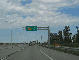
These 2006 photos were taken along the Monteregie Autoroute (A-15) in the area of kilometer-post 49 in La Prairie. There was to be a "directional-Y" interchange with the western terminus of the Richelieu Autoroute (A-6) at this location. Reconstruction work at this location in 2004-2005 removed the wide grassy median that was to be used to connecting ramps to A-6. (Photos by Laura Siggia Anderson.) |
||
|
FROM LA PRAIRIE TO ST-JEAN-SUR RICHELIEU: In the early 1960s, the Minist�re de la Voirie du Qu�bec (MVQ) proposed a second east-west autoroute through the South Shore suburbs of Montreal and the Monteregie Region. The 55-kilometer (34-mile)-long Richelieu Autoroute, which was to receive the A-6 designation, was to parallel the existing QC 104. |
||
|
Early in the planning stages, the MVQ purchased rights-of-way for A-6 in La Prairie. Engineers also performed preliminary work on two interchanges: |
||
|
|
||
|
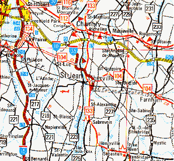
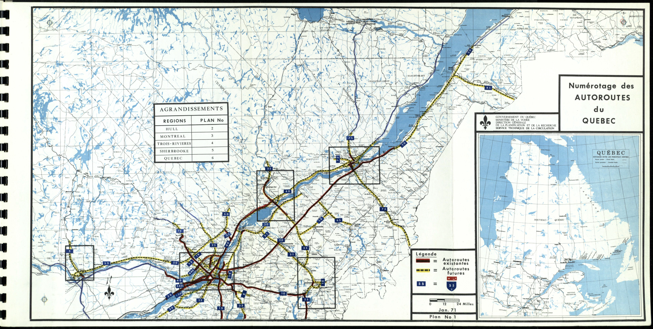
This 1975 map shows the proposed route of the Richelieu Autoroute (A-6) from the southern tip of the existing Vallee des Forts Autoroute (A-35) east to Farnham. An interchange was planned with QC 227 in Mont-St.-Gregoire. The section of A-6 extending west from A-35 to A-15 appeared to have been canceled by this time. (Map © 1975 Transport Quebec.) |
||
|
FROM IBERVILLE TO FARNHAM: As the 1970s began, the MVQ continued to press forward on plans for A-6. The shortened A-6 would have stretched approximately 20 kilometers (12 miles), mostly along an abandoned Central Vermont Railway right-of-way from A-35 (Valley des Forts Autoroute) in Iberville east to QC 104 (Farnham Bypass / Route de Contournment) in Farnham. The province acquired the right-of-way in 1939 for potential use as a future road. |
||
|
In early 1972, the MVQ announced bids for a one-kilometer (1.6-mile)-long segment stretching from QC 104 west to Chemin Lebeau in Farnham; construction began in 1973 on preliminary grading and other work for this segment. The project was put on hold after the 1976 provincial elections, as the newly elected Parti Qu�becois (PQ) formally ended many stillborn autoroute projects including A-6. The PQ diverted most of these funds to develop mass transit. |
||
|
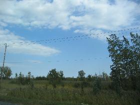
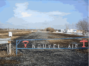
This 2007 photo shows the graded section of what would have been A-6 just west of Farnham. This particular section now is used by a local skydiving club, while most of the rest of the right-of-way is used as the La Mont�r�giade bike path. (Photo by Richard Dupuis.) |
||
|
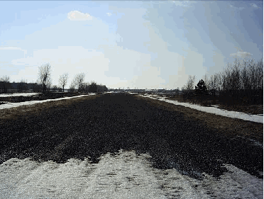
Another photo from 2007 showing the airstrip in the A-6 right-of-way. The airstrip is now owned by Parachute Montreal. (Photo by Richard Dupuis.) |
||

|
SOURCES: "A Study of the Existing Montreal Expressway System" by Dominic Mignogna, McGill University (1969); "Call for Tenders, Minist�re de la Voirie du Qu�bec," Le Soleil (2/17/1972); "Between Farnham and Iberville: the Old Highway Project Sinks Forever" by G�rard Tremblay, La Voix de l'Est (10/15/1983); "Lafrance Wants To Relaunch the Route 6 Farnham-Iberville Project, La Voix de l'Est (3/28/1992); "A Farnham-Iberville Cycle Path: Feasible" by Nicole Paquette, La Voix de l'Est (11/13/1993); "Skydiving School: Don't Touch" by Nicole Paquette, La Voix de l'Est (11/13/1993); F�lix-Mathieu B�gin; Jean-Philippe Carone; Richard Dupuis; Minist�re des Transports du Qu�bec. |
||
|
RICHELIEU AUTOROUTE (A-6) LINKS: |
||

|
Back to The Roads of Metro Montr�al home page. |
||
|
Site contents © by Eastern Roads. This is not an official site run by a government agency. Recommendations provided on this site are strictly those of the author and contributors, not of any government or corporate entity. |
||