
|
|
||
|
This 2011 photo shows the northbound Antonio Barrette Autoroute (A-31 / QC 131) approaching EXIT 14 (QC 158) in Joliette. Until the mid-1980s, A-50 was proposed to meet A-31 at this interchange. (Photo by Scott Steeves, www.asphaltplanet.ca.) |
||
|
Length: |
||
|
14.3 kilometers (8.9 miles) |
||

|
PLANNED SINCE THE 1950s: As early as 1959, Louis-Joseph Pigeon, who represented the Joliette-L'Assomption-Montcalm riding in Canada's House of Commons, advocated for a Montreal-to-Joliette highway at the suggestion of local businessmen and civic organizations. The proposed highway was part of a plan, which included construction of a municipal airport, to develop the Joliette area and help diversify its industrial base. |
||
|
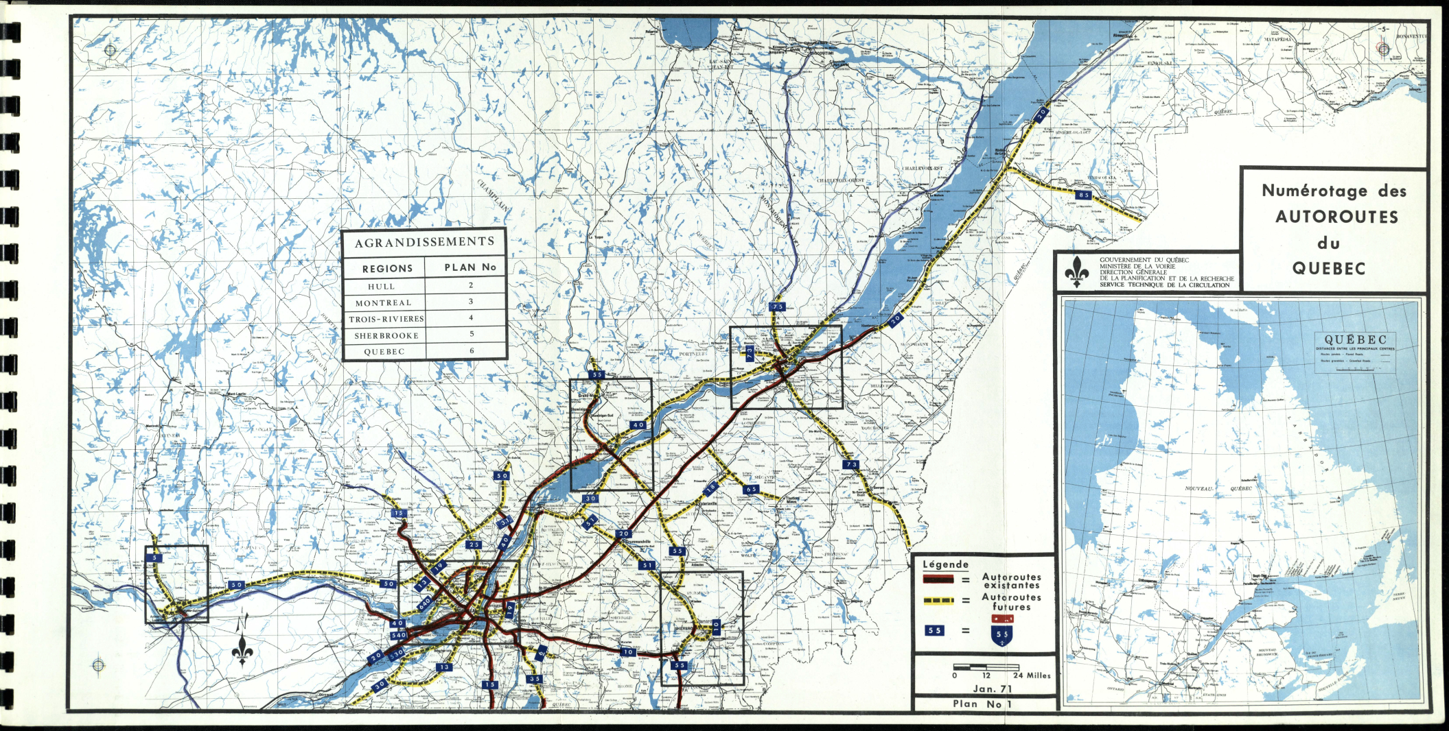
In 1961, local leaders petitioned Premier Jean Lesage to have a freeway spur connecting to the proposed North Shore Autoroute (today's A-40 / Felix Leclerc Autoroute), and that it be included in the initial construction of the Montreal-to-Trois Rivieres segment. In his 1962 budget speech, Lesage said that studies were underway to build the North Shore Autoroute, adding that "a first step in the construction of a modern highway has been taken." Finally, in 1964, Lesage and Guy Poliquin, the President of Autoroutes du Quebec - the provincial agency responsible for building, financing, and operating toll roads - formally announced plans for the initial stretch of the North Shore Autoroute from Montreal to Berthierville. Included in plans was construction of a toll-free freeway connection from the North Shore Autoroute north to Joliette, which became known as the Joliette Autoroute. |
||
|
The autoroute, which was designed with two carriageways each accommodating two lanes, was built primarily through farmland and forested land, which reduced construction and minimized area opposition. |
||
|
The southern terminus at EXIT 1 (A-40) has an unusual configuration at which A-31 transitions into QC 131, a two-lane local road which extends south to QC 138 in downtown Lavaltrie. Extended loop ramps to and from A-40 were built to accommodate a toll plaza, which was eliminated in 1985. Just south of the northern terminus in Joliette, EXIT 14 (QC 158) was built for an easterly extension of A-50 towards Saint-Felix-de-Valois. (A-50 was actually signed on QC 158 for several years in the late 1970s and early 1980s, but these signs were removed when the A-50 extension was canceled.) A-31 ends at Calixa Lavalee Street in Joliette, at which point the autoroute transitions into Dollard Boulevard. |
||

|
This 2011 photo shows the southbound Antonio Barrette Autoroute (A-31 / QC 131) approaching EXIT 1 (A-40 / Felix Leclerc Autoroute) in Lavaltrie. From EXIT 1 north to EXIT 2 (Rang Saint-Henri), slow-moving farm vehicles are permitted to use A-31. In 2008, the MTQ installed electronic variable speed limit signs that reduce speed limits whenever farm vehicles are detected. (Photo by Scott Steeves, www.asphaltplanet.ca.) |
||

|
IMPROVED AUTOROUTE-TO-AUTOROUTE CONNECTIONS: The southern terminus at EXIT 1 (A-40 / Felix Leclerc Autoroute) should be significantly rebuilt to provide improved freeway-to-freeway connections at or near highway speeds. Such reconstruction should include a new overpass over A-40 for local traffic west of the A-31 / A-40 interchange to better accommodate farm vehicles, thus removing a potential safety hazard. The MTQ plans to rebuild the A-31 overpass over A-40 in a C$10 million project over 2026 and 2027, though it did not provide specifics on any interchange redesign. |
||
|
Near the northern terminus, the existing cloverleaf interchange at EXIT 14 (QC 158) should be studied for possible improvements, particularly if the MTQ revives long-abandoned plans to extend A-50 (Guy Lafleur Autoroute) east from Mirabel to Joliette. |
||

|
SOURCES: "Pigeon Suggests That Joliette Have an Airport" by Xavier DeLusigny, L'Etoile du Nord (5/20/1959); "Magog-Omsrville to Rock Island Autoroute Planned," Sherbrooke Daily Record (4/25/1964); "Debats de l'Assemblee Legislative du Quebec," Assemblee Nationale du Quebec (March 1965); Etude d' Opportunite de l'Amelioration de la Route 131 au Nord de Joliette et Examen du Concept d'Amenagement du Contournement sud de Joliette, Ministere des Transports du Quebec (1983); Amenagement de l'Echangeur: Autoroute 31, Rang Saint-Charles, Etude d'Impact, Ministere des Transports du Quebec (1991); "A Turbo-Roundabout for Joliette" by Rejean Turgeon, Journal l'Action (6/14/2013); "More than $264 Million for Transportation in Lanaudiere" by Melissa Blouin, La Revue (5/22/2025); Ville de Lavaltrie; Richard Dupuis; Scott Steeves. |
||
|
ANTONIO BARRETTE AUTOROUTE LINKS: |
||
|
ANTONIO BARRETTE AUTOROUTE CURENT CONDITIONS: |
||
|
ANTONIO BARRETTE AUTOROUTE VIDEO LINK: |
||
|
THE EXITS OF METRO MONTREAL: |
||

|
Back to The Roads of Metro Montreal home page. |
||
|
Site contents © by Eastern Roads. This is not an official site run by a government agency. Recommendations provided on this site are strictly those of the author and contributors, not of any government or corporate entity. |
||