
|
Trois-Rivieres |
||
|
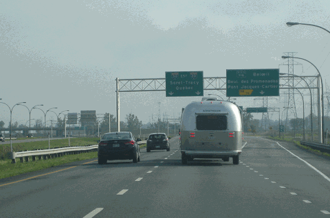
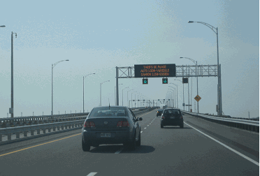
This 2013 photo shows the eastbound A-30 (De L'Acier Autoroute) at EXIT 76 (former EXIT 118) for QC 116 (Wilfrid Laurier Autoroute) in St. Bruno-de-Montarville. (Photo by Steve Anderson.) |
||
|
Length: |
||
|
144.0 kilometers (89.2 miles); |
||
|
Serge Marcil Bridge: |
||
|
|
||
|
|
||

|
PLANNING THE SOUTH SHORE BYPASS: The election of Jean Lesage as Premier in provincial elections in 1960 presaged a sweeping change in numerous aspects of life in Quebec, including transportation. That year, Lesage first announced support for a new freeway linking South Shore towns along the St. Lawrence River from Valleyfield to Becancour. The freeway, which was designed to serve as a bypass for the former Route 3 (now designated QC 132), initially was called "Autoroute de Contournement Sud de Montreal" (South Belt Autoroute), as it was to form part of a southern beltway around the Greater Montreal area. |
||
|
In 1965, the Ministere de la Voirie du Quebec (MVQ) conducted an origin-destination survey along the proposed route in the Greater Montreal area. This survey helped determine the initial plans for the freeway's alignment. The MVQ presented the following rationale for building the new autoroute: |
||
|
|
||
|
The freeway received the A-30 designation in 1966, and in 1968, the MVQ gave the road its current name, "Autoroute de L'Acier," or "Steel Highway," in deference to the steel foundries and ports that line the South Shore. |
||
|
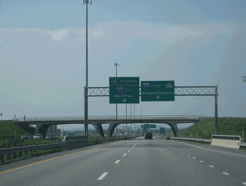
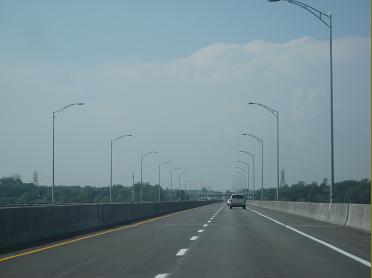
This 2013 photo shows the western terminus of A-30 (L'Acier Autoroute) approaching A-40 (Felix Leclerc Autoroute West) in Vaudreuil-Dorion. The overpass carrying QC 340 over A-30 shown here is a typical design indicative of 1960s autoroute design in Quebec. Until 2012, this section of A-30 was designated as A-540. (Photo by Steve Anderson.) |
||
|
THE FIRST SEGMENT ACTUALLY WASN'T PART OF A-30: Construction of what eventually became A-30 began in 1964. This initial five-kilometer (three-mile) section, which was built entirely through Vaudreuil-Dorion from A-20 (Remembrance Highway) north to A-40 (Felix Leclerc Autoroute West), was opened to traffic in December 1966. This short freeway section allowed motorists from Montreal to continue to Toronto via A-20, or Ottawa via A-40. It was not part of A-30 until the completion of the southern beltway in 2012, at which time the freeway's designation was changed from A-540. |
||
|
A LINK FOR THE EASTERN SOUTH SHORE SUBURBS: The MVQ, and its successor agency, the Ministere des Transports du Quebec (MTQ), then turned its attention to building a link from Montreal's eastern suburbs to Sorel-Tracy. Beginning in the late 1960s, and continuing for the next decade and a half, the province built the following sections of A-30: |
||
|
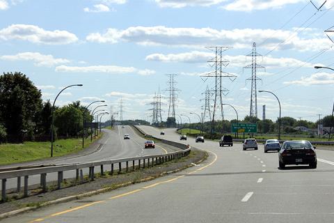
This 2011 photo shows A-30 looking west toward EXIT 138 (Boulevard des Erables / Boulevard de Tracy) in Sorel-Tracy. This section of A-30 was completed in 1972. (Photo by Scott Steeves, www.asphaltplanet.ca.) |
||

|
DELAYED BY PQ MORATORIUM: The first major delay for A-30 construction came following the victory of Parti Quebecois (PQ) in the 1976 provincial election. Upon taking power, the PQ imposed an eight-year moratorium on new autoroute construction in 1977. Although advanced engineering and construction were allowed to continue on autoroute segments already under contracts, most initial planning for new autoroutes stopped, including the A-30 gap between Salaberry-de-Valleyfield and Brossard. |
||
|
Despite the moratorium, pressure from South Shore politicians kept A-30 very much alive. In 1982, the MTQ issued a draft environmental impact statement, or "Regulation Respecting Environmental Impact Assessment and Review," for the A-30 segment between Salaberry-de-Valleyfield and Brossard. The environmental impact review, which established the province's Bureau d'Audiences Publiques sur l'Environment (BAPE), was borne out of a 1978 law that made Quebec the first province to enact such legislation. |
||
|
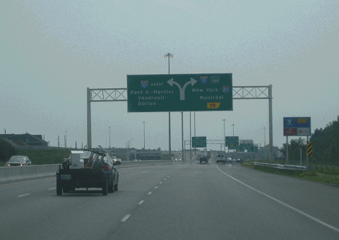
This 2013 photo shows the westbound A-30 approaching EXIT 58 (A-930, to A-15 and QC 132 West) in Candiac. The ramps for EXIT 58 originally were part of A-30 when they were built in the mid-1990s, but when A-30 was extended south and west of Candiac in 2011, the section leading to QC 132 in Delson was re-designated as A-930. (Photo by Steve Anderson.) |
||
|
DEVISING THE SOUTHERN BYPASS: As the new millennium dawned, the Federal government issued a new study on reducing traffic through Montreal. The 2000 Federal study came to the same conclusion that the province reached in its own BAPE studies: that a southern bypass should be built to connect A-20 and A-40 in Vaudreuil-Dorion with the existing A-30 in Candiac. The study recommended that two bridges be built over the St. Lawrence River and the St. Lawrence Seaway / Beauharnois Canal. The province estimated the cost of building the 33-kilometer (20-mile)-long distance between EXIT 5 (A-20 / Remembrance Highway / Autoroute du Souvenir) in Vaudreuil-Dorion and EXIT 38 (QC 138) in Chateauguay, including two high-level bridges and a tunnel beneath the historic Soulanges Canal, at C$530 million. |
||
|
Included in the project was a new three-kilometer (two-mile) stretch of freeway linking the proposed A-30 southern beltway to the existing section of A-30 in Salaberry-de-Valleyfield. This new link, along with the existing A-30 through Salaberry-de-Valleyfield, received a new designation: A-530. The new link to the interchange was to be built as a four-lane freeway from the A-30 / A-530 to EXIT 9 on A-530 (Pie-XII Boulevard), while the existing A-530 (former A-30) was to be widened from the existing two-lane undivided "super 2" to a four-lane freeway for an additional four kilometers (three miles) from EXIT 9 southwest to EXIT 5 (QC 201). |
||
|
Following the 2000 studies, the Association du Camionage du Quebec (Quebec Trucking Association), the largest trucking association in the province, undertook its own study. This study recommended construction of the A-30 extension, stating that its construction would take two million trucks per year off the Mercier Bridge, the Champlain Bridge, the Jacques Cartier Bridge, and the Lafontaine Tunnel. Another study conducted by the MTQ estimated that construction of A-30 would save 20 to 30 minutes for the average rush hour motorist traveling from Vaudreuil-Dorion and Boucherville, compared to similar trips on A-20 and A-40 / A-25. From an economic development perspective, the MTQ estimated the construction of A-30 would add C$8 billion to the local economy and generate 13,500 jobs over a 30-year period, primarily through the development of new industrial parks and warehouses. |
||
|
Under the southern alternative, the remnant sections of A-30 built in the 1990s would receive new designations. The 4.2-kilometer (2.6-mile) segment from A-30 in Saint-Constant north to QC 132 in Sainte-Catherine would be designated A-730, while the 2.5-kilometer (1.6-mile) segment from A-30 in Candiac west to QC 132 in Delson would be designated A-930. |
||
|
The province had to weigh concerns raised by Kahnawake leaders about increased noise and pollution around the northern alternative, which bordered Kahnawake, against concerns raised by farmers about the loss of farmland. Ultimately, the MTQ selected the southern alternative as its preferred alignment. |
||
|
A TALE OF TWO BRIDGES: These two spans were built as part of the public-private partnership between the MTQ and Nouvelle A-30. Both bridges were completed in 2012. |
||
|
BOTTOM: This 2013 photo shows the Serge Marcil Bridge on the westbound A-30 over the St. Lawrence River. |
||
|
AT LONG LAST, AN AGREEMENT: On March 6, 2003, Federal and provincial ministers reached an agreement, at least in principle, to complete A-30. The eastern segment from Saint-Constant to Candiac originally was scheduled for completion in 2008, while the western segment from Vaudreuil-Dorion was scheduled for completion in 2009. At the time, the cost of the projects had risen to C$730 million, including an anticipated contribution from a private partner. Even after this agreement was reached, the Federal and provincial governments required additional environmental studies to be done, and additional agreements had to be reached with Kahnawake leaders regarding land acquisition. |
||
|
On November 3, 2005, the "Highway 30 Bridges Completion Act" was enacted into Federal law, authorizing construction of the western "missing link" between Vaudreuil-Dorion and Chateauguay. Three major crossings were to be built as follows: |
||
|
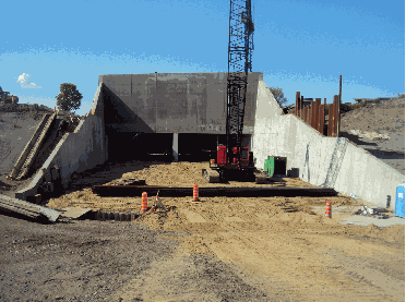
This circa 2010 photo shows construction of the cut-and-cover tunnel under the Soulanges Canal. (Photo by Andrew Cushing, PE.) |
||
|
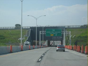
This 2013 photo shows the westbound A-30 approaching the newly completed Soulanges Canal tunnel. (Photo by Steve Anderson.) |
||

|
SOUTHWEST TO THE US BORDER: The original 1960s plan for A-30 had the highway extend southwest along QC 132 from the current western terminus of A-530 in Salaberry-de-Valleyfield to the Quebec-New York border at Saint-Anicet. Owing to low traffic counts on QC 132 southwest of Salaberry-de-Valleyfield, as well as the lack of an Interstate highway connection on the New York State side of the border near Fort Covington, the MTQ did not pursue this extension. |
||
|
FROM SOREL-TRACY TO BECANCOUR: The MTQ has no current plans to fill in the 64-kilometer (40-mile) missing link between Sorel-Tracy and Becancour. However, several municipalities along the QC 132 corridor advanced the following proposal to extend A-30: |
||
|
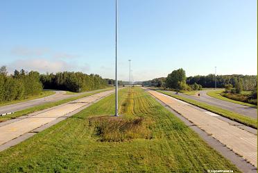
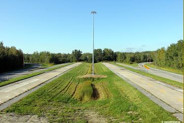
These 2011 photos show the western terminus of the Becancour section of A-30 at QC 132, looking east (left photo) and west (right photo). The unused center roadways were to carry the mainline A-30 west toward Sorel-Tracy. (Photos by Scott Steeves, www.asphaltplanet.ca.) |
||

|
SOURCES: "Caughnawaga Road Plans Have Indians Angry Again" by Gordon Barthos, The Montreal Gazette (5/16/1972); "Mayors Blast Unfinished Autoroute," The Montreal Gazette (7/12/1977); Extension of Autoroute 30, Canadian Environmental Assessment Agency (1995); "Met's Help Is on the Way" by Carroll McCormick, Today's Trucking (6/01/2000); "Highway 30 End in Sight" by Levon Sevunts, The Montreal Gazette (3/07/2003); "Montreal Might Be Disappointed: Experts" by Irwin Block, The Montreal Gazette (3/07/2003); "Saga of Highway 30 Takes Us Back to 1966," The Montreal Gazette (3/07/2003); "Autoroute 30 Completion "a Contentious Issue" in Kahnawake" by Dan Rosenburg, The Eastern Door (3/14/2003); "This Time, It's for Real," The Montreal Gazette (11/06/2006); "Highway 30 Timeline," The Montreal Gazette (11/06/2006); "Highway 30 Bidders Line Up," The Montreal Gazette (1/26/2007); "Quebec Gives Highway 30 Extension Green Light," CBC News (6/03/2008); "Quebec Farmers Join Mohawks in Opposing Highway 30 Expansion" by Stefan Christoff," The Hour (8/14/2008); "Nouvelle Autoroute 30, SENC Signs 35-Year Partnership Agreement" by Peter Kenter, Daily Commercial News (9/24/2008); "Quebec Touts Highway 30 PPP Benefits for Taxpayers," The Montreal Gazette (10/08/2008); "Value for Money Report: The Completion of Autoroute 30," Ministere des Transports du Quebec" (2008); "When Is the Extension of Highway 30" by Marcel Aubry, Le Nouvelliste (9/26/2011); "Will the Extension of Autoroute 30 Be Next?" by Nicolas Ducharme, L'Echo de Trois-Rivieres (1/27/2012); "New Highway Has Region Dreaming Big" by Jason Magder, The Montreal Gazette (10/22/2012); "Highway 30 Will Open December 15" by Jason Magder, The Montreal Gazette (11/29/2012); "Quebec Highway That Skips Montreal About to Open" by Mike Armstrong, Global News (12/09/2012); "Final Section of Highway 30 Opens Today," CBC News (12/15/2012); "Four Quebec Towns Fight Province Over Land Given to Mohawks" by Emily Brass, CBC News (6/27/2013); "R�fection de l'Autoroute 30 entre Sorel et Contrecoeur" by Julie Lambert, Le Journal de Montreal (7/05/2013); "Ground Engineering for the Autoroute 30 PPP Project," Department of Civil, Architectural, and Environmental Engineering, Missouri University of Science and Technology (2013); "Sorel-Tracy Wants To Start Extending the A-30" by Julie Lambert, Le Courrier Sud (8/31/2017); "Soulanges Canal Tunnel, Autoroute 30" by Andrew Cushing, PE, LinkedIn.com (10/16/2019); Dragados USA; Ministere des Transports du Quebec; Richard Dupuis; Scott Steeves. |
||
|
DE L'ACIER AUTOROUTE LINKS: |
||
|
DE L'ACIER AUTOROUTE CURENT TRAFFIC CONDITIONS: |
||
|
DE L'ACIER AUTOROUTE VIDEO LINKS: |
||
|
THE EXITS OF METRO MONTREAL: |
||

|
Back to The Roads of Metro Montr�al home page. |
||
|
Site contents © by Eastern Roads. This is not an official site run by a government agency. Recommendations provided on this site are strictly those of the author and contributors, not of any government or corporate entity. |
||